Street View came into the picture as a part of Google- sponsored research project with Stanford University in the year 2001. It was finally released in 2007 and since then it has been the most significant feature of Google Earth and Google Maps. This profound technology has come a long way after that with additional features like 3D models facilitating selection of cities around the world.
With the help of advancements in Street View, you get a window into various changing ecosystems in the world and you would learn how non-profit organizations and others are making efforts in keeping our planet safe and healthy. One such example is the efforts made by the scientists at The Nature Conservancy in California in order to keep track of the health of blue oak trees.
Due to the changing climate, the population of trees have declined drastically in recent years. Hence, the ability to maintain digital records for research and comparative purposes will allow the scientists to form better approaches to conserve tree population in Central California.
As it is said, with every positive comes a negative. In the same way, although this technology has provided many benefits to the world, it has few setbacks too. One such instance came into the picture in 2010 those Street View cars that were operating in Europe were found collecting passwords, emails and other data from open WiFi networks. Hence, Google was fined in Germany after admitting that data collection took place.
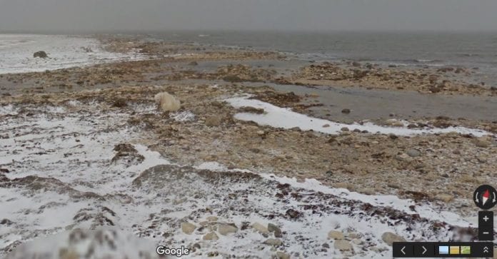
Polar bears are found to be in trouble due to the melting sea ice on which their survival depends. For this reason, Polar Bears International (PBI) borrowed the Street View Trekker to map them in their fragile melting ice condition around Churchill, Manitoba. Trekker is a backpack with a camera array designed mainly to take photographs in locations which are inaccessible by ground vehicles, for example, dense forest of Brazilian Amazon.
Street View is not just limited to take pictures; it has measured other climate variables too. Methane analyzers are equipped to Google’s Street View cars which help in detecting any gas leaks from the service lines under city streets in U.S. the data is of high importance in order to take required remedies. In a partnership with Aclima, Google Earth Outreach has made plans in measuring various pollutants such as particulate matter mostly in the Californian communities in 2016.
Earlier Google’s hidden data collection idea got a lot of criticism from privacy advocates in the past, but now the same technology is being used in order to improve various climatic conditions and helped in changing the adverse environmental effects.


